
New Years is one of those holidays that we consider amateur hour. I mean, it ranks right up there with St. Patrick's day and 2 hour beer lines for green bud light. Why? ick. I like real beer if im going to pay $4.50 a bottle. Anyhow, thats neither here nor there but usually we spend our New Years off the beaten path and usually in our tent by 10pm. It's generally another night in the field where we are trying to escape the crazies, not join them. Well, this year would be different. We were heading to Saline warm springs, deep in the heart of Saline Valley. And it would prove to be one heck of a party.
For several weeks before the trip we were monitoring the passes into the valley. See, there's 4 ways into Saline. Many of which can become impassable with winter weather (snow drifts at 5,000-7,000ft). With all the rain and crazy weather we've been having in Southern California lately, we didn't know if we were going to make the trip, but we weren't easily discouraged either.. heck it just made it that much more of an adventure. So with chains for all four tires and enough food packed for 2 weeks if stranded, we were set to shove off come hell or high water.
The days before departure we were pleasantly surprised with blue skies and reports that the route we wanted to enter in was open and clear. I must say, It helps to have friends with satellite phones and ham radios to help set you at ease. And yes, i will admit i worry way too much sometimes, but i guess thats better than going un-prepared.
Our route that we chose was south pass. Since we were meeting our friend near Lone Pine the night before. It was closest to access, however it was one of the longest entries at nearly 60 miles off pavement to camp. A long haul. We proceeded to air down and head in. With a quick stop at box car cabin we made it over the pass and into the valley. The view was spectacular. From this point it would take another hour and a half to get into camp. Two and half hours total from pavement. I've heard of people taking 4-6 hours.


Saline is a little gem kept in the northwest corner of a Death Valley national park. It's a gem because it houses natural hot springs that many people can't access due to remote conditions. Many Californians don't even know about nor do they want to bother with driving all the way out to it. Every year, vehicles become stranded due to several flat tires, break downs and crashes from ruts. Generally speaking this keeps the rift raft out and the cool, hardcore people in. The springs are one of the most amazing places in the park, people skinny dip and relax in the warm soothing pools and people say, you either "get it or you don't" It's a place to relax, unwind and be one with nature. Your closest camping neighbor at the springs can be from Quebec, Australia or even Russia at any point. Europe really seems to love it here. Another great thing is the rigs that show up here. At any given point you may see a Unicat, Unimog, a Pinzqauer, Alaskan camper, or some really cool home built rig traveling the world. People come from all over the world to enjoy this great place and it's no mystery why, once you've been there. It's truly amazing.
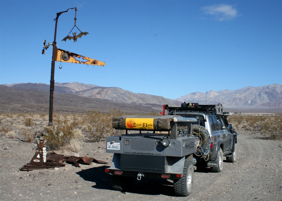
Heading up Bat Rock Rd with the Inyo range in the background.

The official symbol of Saline is the Saline Bat. Here we made a quick stop on the way into the lower springs.
After arriving at the springs we took a gander at the tubs and feeling the temps. It's really amazing what they've done here. The springs have actually been "tapped" so to speak and people have come in and put in plumbing to new pools built by folks on site in the remote desert. There's even showers before you get in. It's all about respecting others and keeping the pools clean.

A shot of the source.

Yosh testing the waters.

Camping is dispersed and it's a pack it in pack it out location. The national park does not maintain the bathrooms or any of the facilities so its up to the users to keep it clean and functioning properly. The park service as always is looking for anyway to shut it down, so when traveling to Saline always remember to be respectful to land owners, bring toilet paper, bleach, anything you can to help out and of course don't leave your trash!
Camp for the night. The springs are in the distance top left.


We chose to camp halfway between the lower springs and the upper. I like to be somewhat away from people instead of stacked on top of each other, plus you can't beat the spectacular views of the snow capped Inyo mountain range in the distance.

Since we arrived on New Years eve.. so mine as well participate in festivities. I broke out the big can of Fosters. Crykies!

Somehow a fleet, a murder or a gaggle of 100-Series Landcruisers appeared. Im only kidding, a few of them were with us and another showed up later in the day. All were from out of state, one Nevada, one British Columbia and another from Oregon. It was epic to see people drive that far to meet up. All members of ih8mud.com

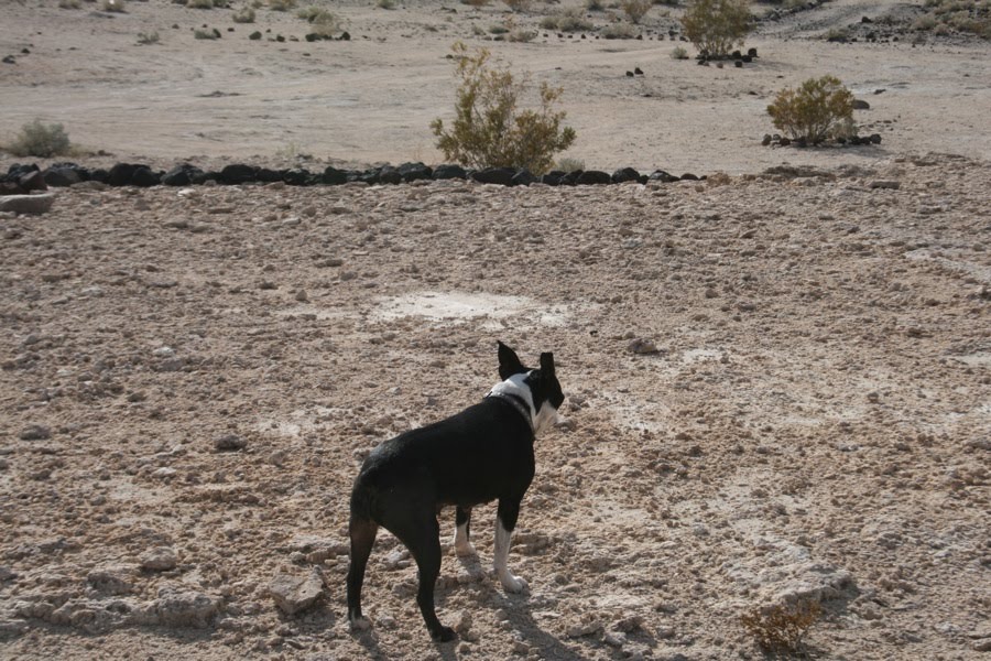
It wasn't the warmest weekend to head out to desert, but a friends dog "buddy" didn't seem to mind in his cozy jacket. Detective bones in the house. He just needed a pipe in his mouth. "hello governor"

The temps dropped down into the mid 20's at night so needless to say we started in on the fire. The crazy guy behind Yosh will remain nameless at this point in time.

Buddy was a complete gentlemen and let Dixie use his giant bed. All the while he tried to use Dixie's. It was hilarious.

As the night went on, we grilled up some brats, chicken and pork ribs over charcoal on the notebook grill then proceeded to drink way too much in the midst of the New Years celebration (the one we don't usually celebrate, remember?). We visited with the rest of the group at the lower springs, then closed the night in the Wizard pool with Jello shots in the midnight hour. It was quite the party. Needless to say, i won't go into exact details.. but we had a great time and were seriously hurting the next morning.
The next day, we woke up to beautiful skies and warm sun rays. Dixie took full advantage.

A friend attempting to snooze on his cot, pretty sure he was still hurting from all the festivities.

Dixie and i went for a walk.
Notice how well everyone takes care of this place. I mean people really spend time gathering rocks, making paths, even setting up make shift camping sites for folks to setup in so as to lessen the impact of people roaming freely. It's quite nice.


The Wizard sign. The Wizard is an old timer that they named a pool after.

A trippy design someone made.

The bat sign again, this time someone took some major time to layout a ton of volcanic rock.

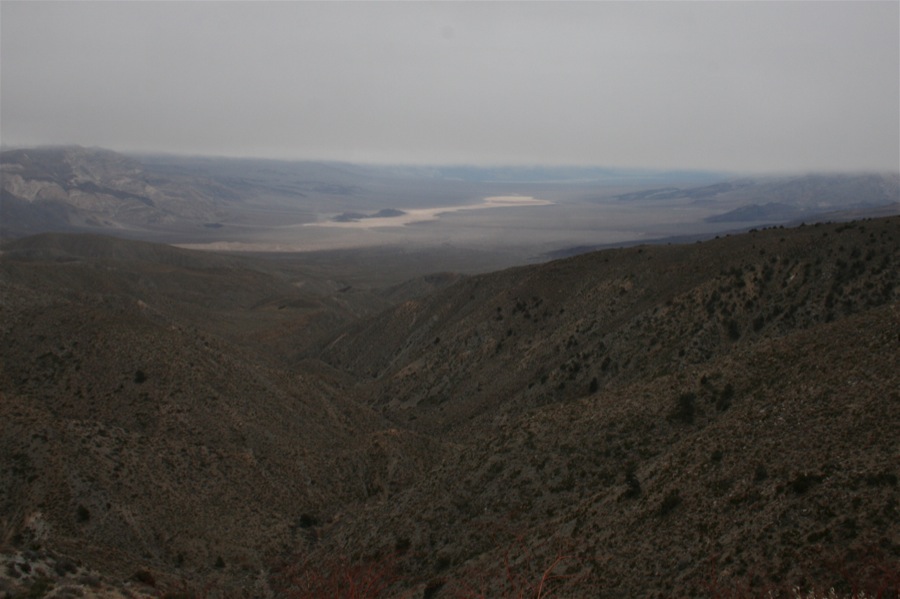
After a bit of relaxation, making breakfast and taking a nap we decided to head out to explore a bit. Our friend that's a local in the area took us over to Beveridge canyon across the valley from the springs. Along the way, the views were stunning as the sun started setting in the west.

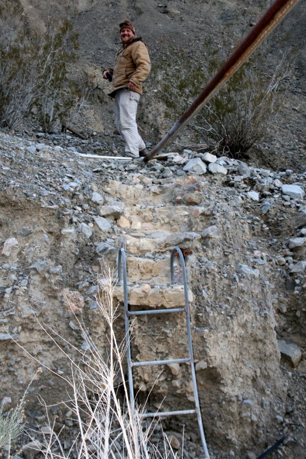
After negotiating our way up the canyon through plenty of washouts and deep ruts. The trail stops at the superintendent's cabin.

The inside of the cabin was interesting to say the least.


Maybe they wanted vaulted ceilings?

Some great old photos on the wall, looked like replicas though and not originals.


Hideous couch cover, but check out that crazy shag carpet.

No matter how bad it gets, you'll still be warm.

And smart too, there's a full set of encyclopedias on the shelf

The view from the canyon.

Ladder behind the cabin leads to a small junkyard full of interesting finds.
People love building weird things out in the desert don't they?

Chris takes a ride in an old dump truck. Funny, the key was still in the ignition after all these years.

Beveridge Canyon was a mining operation way back in the 1800's. A snipet from the BLM website reads... Beveridge Canyon in the Inyo Mountains Wilderness is the site of the historic Beveridge Mining District. From the 1860's through the 1930's, mining occurred in this isolated canyon on the east side of the Inyo Mountain Range. The canyon is very inaccessible and in a very isolated and remote area of the Mojave Desert.
Most of the historic mining activity in the Beveridge Mining district occurred along a 2-mile linear segment of Beveridge Canyon from an elevation of 6,000 feet down to 4,500 feet. Today, there are the remains of various small pieces of mining equipment, several small mining operations, and the partial remains of several small habitation rock structures along the 2 miles of canyon bottom.
There's history everywhere you look. It's a photographers paradise.


We ended making the small hike up to Beveridge Falls. Dixie needs more clearance and stronger paws for climbing through the rocks, so i ended up picking her up the last half of the way.

Fall number one.

Chris even made it up to the second fall with his dog. Amazing what balance animals have. In this shot you see him perched up on a boulder above the fall.

The sun was setting so we headed back to camp. It took us close to an hour to get out so we knew we'd be arriving at camp just at dark. I pushed it a little too hard on the way back and blew out the front right tire. With proper tools i was able to air up the tire, reseat the bead and limp back to camp unscathed. It's much easier to replace the tire at camp at your leisure then being in the middle of the road so thats what i opted for.

After fixing the Cruiser we proceeded to grill a pork tenderloin and stay in for the night. The partying the night before wore us out and we weren't in any mood for round number 2. We gathered around the campfire and kept it a quiet night and the pooches tucked in a huge bed together to stay warm. Even though others headed over to the tubs for some relaxation, this was more our style.

The highlight of the night was when Chris made his Pineapple upside down cake in his dutch oven. It was epic.

The next morning we packed up for home at a steady pace. We needed to get out of the valley before the next wave of storms hit.
On the way out of the valley we passed by the famous Saline Salt tram. It's really quite an interesting piece of history. They carried salt from the dry lake up and over the Inyos to a facility on the other side in the Owens valley. Pretty spectacular to think engineering like this took place way back then and that they actually executed it so well.
Here you can see whats left of the salt tram uprights heading across the lake bed.

If you look closely you can see them cross over the range. Pretty wild to think it wasn't uncommon to hitch a ride over in a bucket if you worked for the operation.

I could go on for days about the salt tram, but that's a whole other blog in itself of history and photography. For some more history and info on this major piece of history visit this website
Rounding the corner near Hunter mtn turn off, we caught a great view of Panamint Valley and the Panamint dune range.
Coming up over the pass and switchbacks we crossed some frozen creeks and a bit of a flurry, but no real snow. We were escaping at the perfect time frame. Because it was getting worse.

Rounding one of the corners coming back via South Pass we ran into some cattle blocking the road.


They really didn't want to budge. I had to nudge them along with my bumper. Even honking my horn didn't seem to bother them.

Making our way back along the Joshua tree forest

Even had to wipe my window with a rag because my wipers stopped functioning. All part of the fun right?

Arriving back at the highway to air up. Notice the signage.

After airing up, we proceeded through Panamint Valley and Trona way. I like that route better than 395. Heading out of Trona to Red mtn we caught some beautiful low elevation snow fall. It was very unexpected.

We're talking barely 2,000 feet in this area. I was stoked to be able to see it.

Upon further travel south we dumped out off the 395 and noticed the cars basically parked on the Interstate 15. See when it snows in Southern California drivers aren't used to it because we don't get it enough. Our winters don't last very long and it's usually bright and sunny here. So the CHP and the state shut down roads in a blink of an eye. It's unfortunate for us that can actually drive in it and are prepared with chains and whatnot. Anyhow, so because it hardly ever snows on the Cajon pass we were led down by police escort group by group. This made for a very long drive home. It took us nearly 3 hours to go 15 miles and i had to stop 5 times in the dark to wipe my windshield. On the other side of the coin, we were just happy to make it down before they closed the entire route.
At the end of the day, we were still happy of what we experienced like all of our trips and we'd do it again in a heart beat. After all it's all part of the adventure!
Photos by Adventureduo, Chris Johnson and 1loudLX ©