We haven't posted many trip reports lately and this is the reason why.

So, every so often i get an urge to push myself. I'm not the kind of person that sits around and waits for things to happen, nor am I one of those people that sit on the couch stuffing my face with bon-bons. Last December i made the decision to tackle the tallest peak in the Lower 48 states. Mt. Whitney at 14.505 ft above sea level.
I'll admit it right off the bat. I don't hike or at least i didn't when i started this assignment. In fact if you look back at our trip reports, 99% of them were vehicle based and only a small few were hike related. Sure, i'll do some hiking from camp to a remote lake or up a huge sand dune but for the most part this was my entry into hiking.
So once i secured my permit, which is a lucky process as it is (won't go into that here) i started training 6 months in advance.

First couple hikes were small to break my legs in and within time i started building up higher elevation and longer mileage day trips. With our goal in mind of hiking to the summit of Whitney in one day meant i had to be in shape to do at least 22 miles and 6,000 ft elevation gain in one continuous day hike. There's different schools of thought on what works better for your body, break it into 2 days and camp or do it all one day by getting up in the middle of the night and hiking at night. For us, we felt less stress and less gear making the hike easier, although hiking for 15+ hours may not be easy for some.
Since we're the AdventureDuo, i volunteered Yosh to get out and go on a couple of these training hikes with me. The first was to summit Orange County, California's highest summit at 5,689 ft. Santiago Peak.

The day was long but exciting as we paced ourselves for the longest hike we've made. With a 4,000 ft. elevation gain and a 16 mile round trip it would prove to be just as described. Strenuous.

Pushing ourselves we made the towers just after lunch and approached the parking area just before dark and right before rain fall. We were exhausted but pleased to say we "bagged" our first peak in just over 9 hours. The following days we ended up sore and it hurt to walk. A true sign of a beginner, a good sore.

Our next hike would be starting at higher elevation, but not as many miles. Basically just to open up the lungs and see how we felt. Being that we lived primarily at sea level, this was a good test. The entire time we were hiking we were also in the gym swimming, doing cardio and lifting weights. We headed up to a friends cabin in the local mountains and went for a fun hike with no set goal. Located in the San Gorgonio Wilderness, the trail is called Vivian Creek and takes you up to the highest peak in Southern California, "San G Peak". The trail starts up around 6,000 ft and eventually climbs it's way up to 11,500 ft.

Keeping a mellow pace and turning around where we felt best, we gained about 1500 feet with an 8.5 mile round trip. Again, just a lung opener.


Since the last hike we actually moved to the mountains and were living at 5,700 ft. This would mean acclimation would be a tad easier for me and give me a bit of an advantage. The nice thing about living in the mountains is that we had trails in our backyard and we could train after work for small couple mile hikes. This also builds a nice appetite for dinner afterwards.

A few after work hikes, i blasted as fast as i could to a pre-determined destination. Talk about exhausting! It made for a good workout though and even better training.

So after a couple small trips with Yosh, it was time to call in the boys for a long haul. I set up to arrange a date for a training hike to the tallest peak in So-Cal. Yep, San G. Or as many call it, "Old Greyback".


There's multiple ways of climbing to the top of "San G". The fastest and the steepest is via Vivian trail i spoke about earlier. This wastes no time and climbs to the top in about 8.5 miles and 5700 ft. elevation gain. Since it's the fastest way up it's very crowded and you'll be leapfrogging with folks the entire day.
Arriving at the summit.

After recovering from the Vivian Creek Trail to San G, Yosh and I took a exploration hike up Momyer. Momyer is the long way up to the top of San G. On this particular hike we would just set our goal on having fun and enjoying the wilderness.

This trail is 13 miles long with 6100ft. elevation gain if you take it to the top of San G. It's very strenuous, long and has very few hikers/low traffic. There are several springs to get water if you use a filter and there's several camps you can stay at if you want to break it into a multi-day.


The trail starts off steep then levels out pretty good and stays consistent. On this day, we made it in only about 3-4 miles because we wanted to keep it fun. It was also pretty warm out as well and the coverage on this trail is slim to none in most areas.

Yosh trucking along a steep narrow passage. She did a wonderful job for someone not so pleased with heights.

We took a break for a week and tried again. This time the weather was even warmer and we had a goal to make it to Alger Creek for lunch.

Yosh making her way back up after having a nice lunch at the creek.


After making that hike, i had a new training goal in mind. I wanted to make a high-mileage single day trek up Momyer and back down Vivian. The total mileage from the house and back in a loop would be upwards of 24-26 miles. This would be my last training hike and hardest day hike yet, before i departed for Whitney. It would also mean i'd need to carry plenty of water and fuel for the long haul.
Heading up the backside of San G. You can see the tree line start to disappear as you approach 10,000 ft. and higher.

This is the reason why they call San G, "Old Grey Back". The slide area on the backside is incredible. Also, not a place you want to slip or lose your grip on the trail. It's a long ways down for sure.

Making the summit for the second time. So-Cal's tallest peak the long way. Bagged. This time SOLO.

I ended up making it home around 7pm after leaving the house at 6am. Pretty quick and averaged 2mph the whole way with a 20 mins break for lunch. It was now time for a rest as Whitney would be the next hike.
Little did i know that i'd twist my ankle coming down the stairs in the dark carrying Dixie (our Boston Terrier). I immediately iced and heat padded it right away with good advice from friends and family. I also stayed off of it and rested no matter how boring it became. After all, i didn't prep this much to not make the trip.

Thankfully after days and almost two weeks of rest, my ankle felt great again. I went out for a small test hike after work up the canyon cross-country with no trail. No problems to speak of and i knew i was ready as i'd ever be.

The time had come. Whitney was at our doorstep. We checked the weather and packed accordingly. It was going to be chilly and we might get a storm. After picking up our permit at the Interagency office in Lone Pine, we grabbed a bite to eat and headed for our hotel room. We would turn in early because the next day we'd start hiking at 3am in the dark.
This was our route. 11 miles one way to the summit.

As we started we knew it was going to be cold. Later we'd realize it didn't rise above freezing all day. Again, we were prepared and warm.

We heard weather reports of snow after 11am from 8,000 ft. and above. We were ready for it, but wanted to see if we'd beat it. As the sun started to rise, we started to notice a storm rolling in earlier than expected. We pressed on in hopes it would burn off.
After about 6 hours on the trail and feeling good, the weather started to set in and made the trail hard to see, icy and impassable. We started to see people heading back down that we were hiking with all day. They shook their head and let us know, it didn't look like it was getting any better. We continued on.

At lunch break around 6am we started to get snow fall. It's not every day you capture a perfect snow flake in a photo. For reference this photo was taken on the finger of a glove. That's how small it was.

We pressed on while our camel backs froze, our Nalgene bottles froze and our trekking poles stopped locking properly. People were reporting 45mph winds/14 degrees with a -5 wind chill just up around the bend from our location. It was getting worse. Even springs started to freeze.

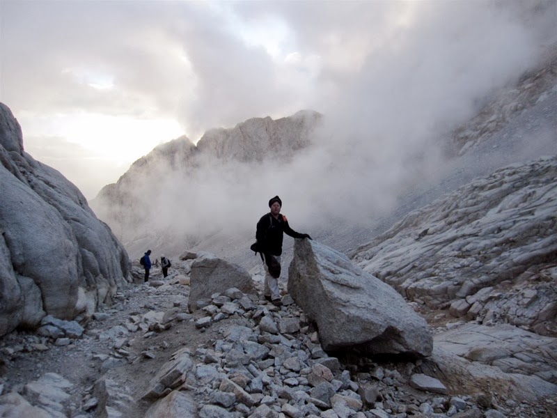
Heading up the switchbacks. You can hardly tell where the trail continued.

Approaching the cabled area, we finally called it. It's simply not worth dying. At this point one of the springs froze and there was black ice over the the trail. It just so happened to be right where the cable was down too. We didn't have crampons and even if we did it wasn't a sure win for conquering ice on rocks. One slip and you're off the side.

You can see the cabling that was down on the trail up past where im standing.

All but one group turned around that day. When you're on a mountain such as Whitney, you need to play it smart. That peak will always be there next time, you only get one life. We sucked it up and turned around feeling fine about it. If it was human error or a problem with one of us mentally or physically i'd be angry, but because it was due to mother nature I was fine with it 100%. No regrets. We made it within 2+ miles of the summit and about 12,700 ft.
We headed back down and enjoyed the beauty every step. We still had 8-9 miles back down. This wasn't an afternoon jaunt still. We had to get off the mountain and take our time. The sun was peaking out every once in a while and creating more ice on the rocky trail.

Lakes that we passed earlier in the hike were now freezing over.

Some of which you couldn't even recognize or pick out in the fog. Rocks now looked more like glaciers. It was stunning.

Rock formations were now covered in a dusting of white. Coming up in the dark and now coming back down in the daylight during a storm made it like a whole new trail. Truly epic.

Looking down at Consultation Lake from the the trail.

Spectacular views no matter which direction you looked. This granite wall reminded me of Yosemite.

Ancient tree's flocked in powder. Absolutely beautiful.

Mirror Lake living up to it's name. Breath taking.

Exiting the Canyon and heading towards Outpost camp.

Still very cold. I think several springs where we planned to get water froze up.

Chilly place to rest in Outpost Camp.

A waterfall in the distance not yet frozen over.

Takes a bit of cold to get icicles to form on a boulder i'd say.

A little exploration is always good for the soul. Even if it was slick and dangerous.

We found a perfect cave formation a person or an animal could take cover.

Crossing over the logs to safety. Until someone goofs off and ends up in the drink.

Other times of the year, this can be completely filled with water from edge to edge. The fun part is crossing it in the dark with a head lamp on the way up.

In the end, the trip was still epic and will always remain one of my favorites even if we didn't summit. The area is beautiful and the John Muir wilderness is something you'll never get used too. We made it down to Lone Pine, warmed up and grubbed some pizza.
My hiking buddy has made the summit 5 times, but we will put in for permits next year and hopefully 2014 will be my year to summit.